
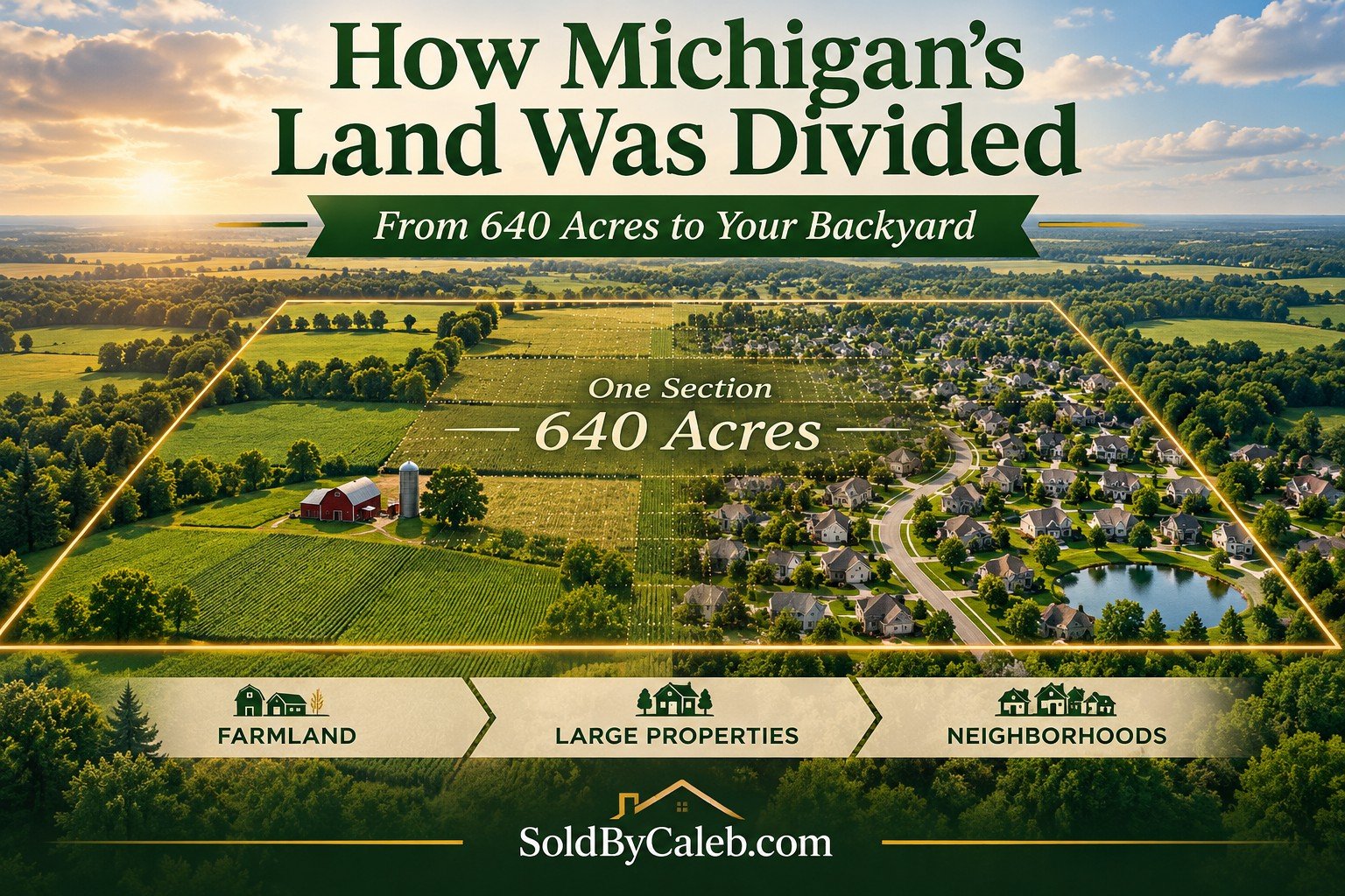
The history behind property lines, townships, and the land we own today.
Every piece of property in Michigan has a legal description. Whether it's a small residential lot, a 10-acre parcel, or a 100-acre farm, that description identifies where the land is located.
But who originally decided where those property lines would go?
The answer takes us back more than 200 years, when surveyors began dividing Michigan into a grid that still influences property ownership, roads, and neighborhoods today.
Before the Property Lines
Long before Michigan became a state, Native American nations, including the Ojibwe, Odawa, and Potawatomi, lived throughout the region. They had established communities, territories, and ways of using and managing the land.
As the United States expanded westward, the federal government began surveying land to establish a standardized system for ownership and sale.
The Land Ordinance of 1785 helped establish what became known as the Public Land Survey System (PLSS).
Instead of relying entirely on descriptions involving trees, rivers, and neighboring properties, surveyors could identify land using townships, ranges, and sections.
This system became the foundation for much of Michigan's modern property records.
Michigan's Starting Point
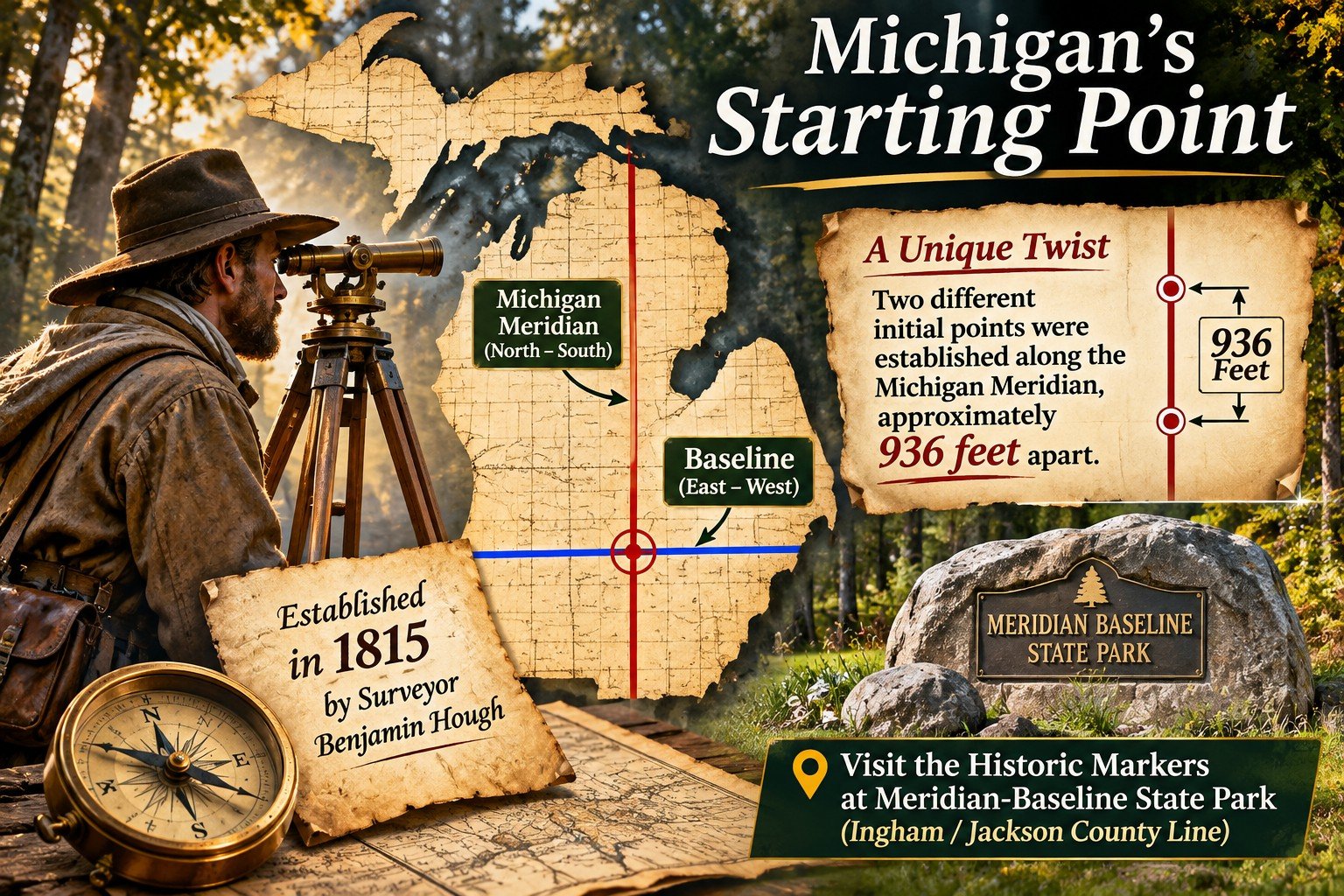
Michigan's original federal surveys began in 1815.
Surveyor Benjamin Hough established the Michigan Meridian, a north-to-south reference line. An east-to-west baseline provided another reference.
Together, these lines created a starting point for locating land throughout Michigan.
But something unusual happened.
Early surveying work resulted in two different initial points along the Michigan Meridian, approximately 936 feet apart.
Rather than discard surveys and property descriptions already established, the two points remained part of Michigan's surveying history.
Today, the markers can be found at Meridian-Baseline State Park, near the Ingham and Jackson county line.
It's a fascinating reminder of how decisions made by early surveyors continue to influence land records generations later.
How Michigan Was Divided Into Townships
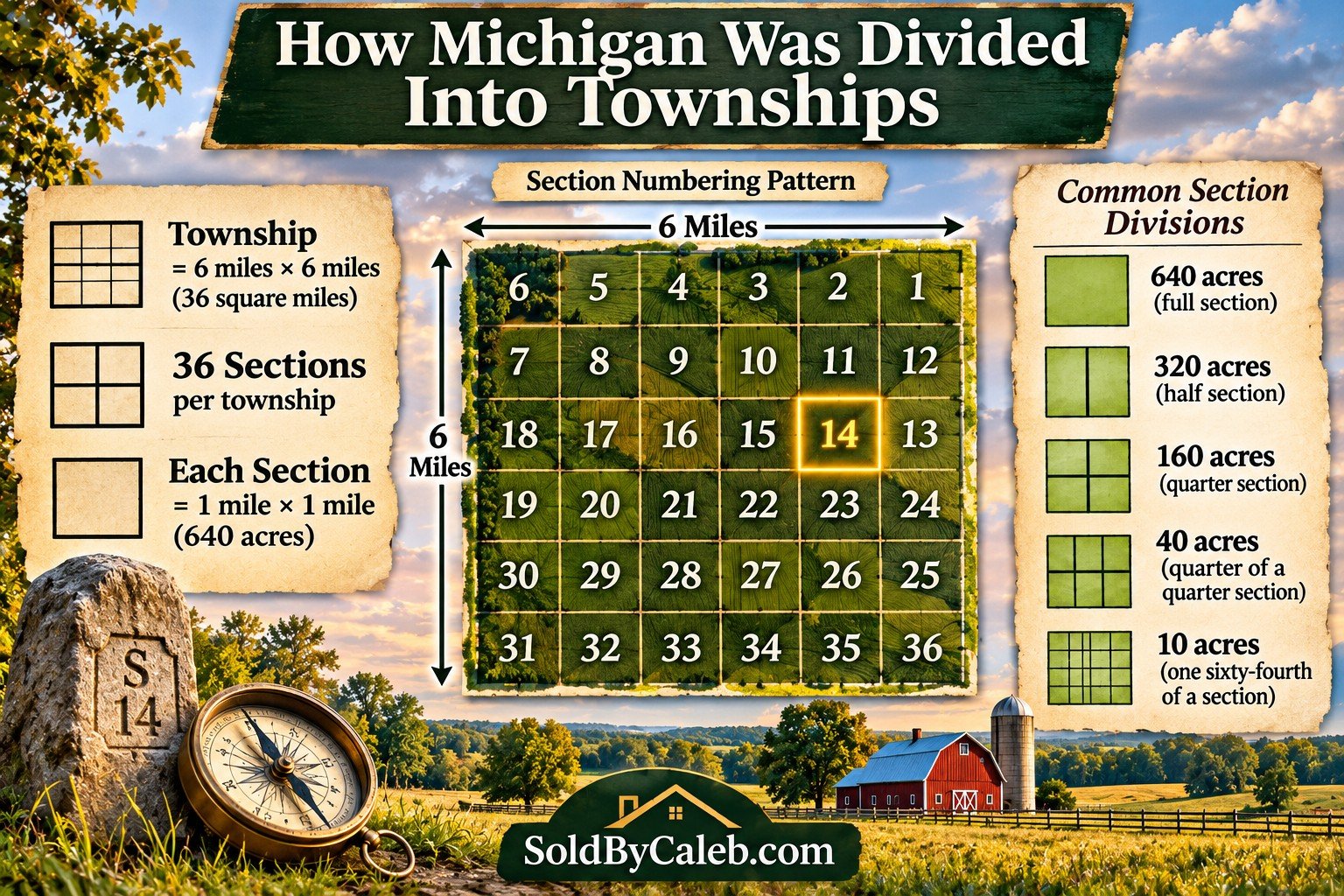
A standard survey township measures approximately six miles by six miles, covering 36 square miles.
Each township is divided into 36 sections, numbered in a back-and-forth pattern.
The numbering starts in the northeast corner:
Each standard section measures approximately one mile by one mile.
That equals 640 acres.
Townships are identified by their position north or south of the baseline, while ranges identify their position east or west of the Michigan Meridian.
For example, Township 2 South, Range 8 East identifies a particular survey township in relation to those reference lines.
These survey townships are different from Michigan's local township governments, although their boundaries often share the same surveying origins.
From 640 Acres to Your Backyard
Once surveyors established the sections, the land could be divided into smaller parcels.
Here's how the math works:
640 acres: One full section
320 acres: Half a section
160 acres: Quarter section
80 acres: Half of a quarter section
40 acres: Quarter of a quarter section
10 acres: One sixty-fourth of a section
These divisions helped create farms and other large properties.
As communities grew, landowners and developers divided those properties further.
A former 160-acre farm might eventually become a residential subdivision with streets, utilities, parks, and individual home lots.
This is how land that was originally measured in square miles eventually became the neighborhoods we recognize today.
Why Do So Many Michigan Roads Follow a Grid?
If you've traveled through Southeast Michigan, you've probably noticed long, straight roads and intersections that seem to follow a pattern.
Many of these roads developed along section lines and other survey boundaries.
A section is approximately one mile across, which helps explain why mile roads and regularly spaced intersections are common in parts of Metro Detroit.
However, not every road follows the original survey grid.
Older travel routes, waterways, railroad lines, terrain, and later development also influenced road locations.
The survey system helps explain much of the pattern, but it wasn't the only factor in shaping Michigan's roads.
Why Aren't All Property Lines Perfect Squares?
The original survey grid provided a framework, but actual land boundaries are more complicated.
Several factors influence the shape of properties:
Lakes, rivers, and shorelines
Survey corrections and measurement differences
The curvature of the Earth
Existing roads and transportation routes
Subdivision layouts
Property divisions and boundary adjustments
Surveyors also had to account for the fact that north-to-south lines converge as they approach the North Pole.
As a result, not every section contains exactly 640 acres, and not every township forms a perfect square.
The actual boundaries depend on the original surveys, subsequent records, and legally established property descriptions.
Understanding a Michigan Legal Description
When reviewing a deed or other property record, you may encounter language such as:
The Northeast Quarter of Section 14, Township 2 South, Range 8 East, Michigan Meridian.
Here's what that means:
Northeast Quarter: The northeastern quarter of the section
Section 14: One of the township's 36 numbered sections
Township 2 South: The second survey township tier south of the baseline
Range 8 East: The eighth survey township column east of the Michigan Meridian
Michigan Meridian: The principal surveying reference line
A standard quarter section contains approximately 160 acres.
This is a simplified example. Actual legal descriptions may contain additional information, exceptions, recorded plat references, and detailed boundary measurements.
In established subdivisions, legal descriptions often identify a lot number, subdivision name, and recorded plat rather than describing the property through quarter sections alone.
What Does This Mean for Property Owners Today?
The original survey system is still important when researching property.
It helps explain:
Where property boundaries originated
How large parcels were divided
Why neighboring properties have different shapes
How legal descriptions identify land
Why a property's recorded acreage may differ from a simple calculation
Understanding the survey system is useful, but locating the exact corners and boundaries of a particular property is a different task.
A professional boundary survey uses the applicable records and physical evidence to establish property lines.
For more information about surveys, boundary markers, and easements, read my Property Survey Basics: Boundaries, Corners & Easements.
Explore Michigan's Surveying History
If you'd like to learn more, these resources offer additional information:
Meridian-Baseline State Park, where Michigan's historic survey starting points are preserved.
Bureau of Land Management, Cadastral Survey, information about the federal land surveying system.
Michigan Department of Natural Resources, resources covering Michigan's land and natural history.
Every Property Is Part of a Bigger Story
The property lines around your home are part of a system established generations ago.
What began as large sections of surveyed land eventually became farms, neighborhoods, commercial properties, and the individual parcels we buy and sell today.
Understanding that history gives us a better appreciation of how Michigan developed and why property records look the way they do.
For more information about Michigan properties, land, and homeownership, explore my Real Estate Guides or Home Buying Resources.