
Property Survey Basics: Boundaries, Corners, and Easements
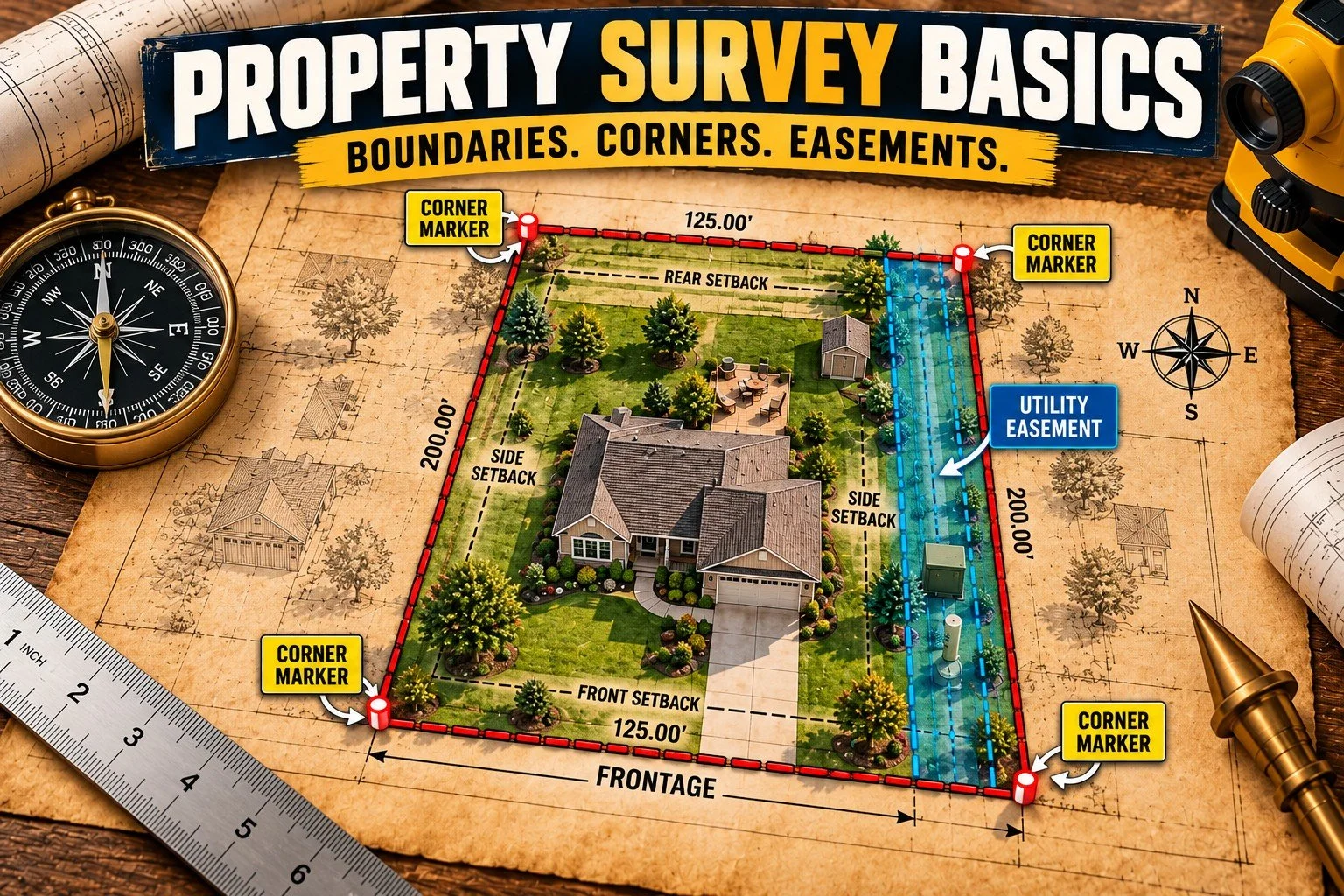
Where does your property end and your neighbor's begin?
A fence, driveway, or row of trees may look like the property line, but that doesn't mean it is.
A property survey helps determine the location and dimensions of a piece of land. It can also show important details that affect how the property is used.
Here are seven things Michigan buyers and homeowners should understand.
1. Property Boundaries
A boundary survey determines where a property's legal boundaries are located.
A licensed surveyor reviews property records, examines physical evidence, and takes measurements to establish those boundaries.
This is especially useful when buying land, installing a fence, or questioning where one property ends and another begins.
2. Property Corners
Property corners mark the points where boundary lines meet.
Surveyors use markers, often metal rods or other permanent monuments, to identify these locations.
Finding a metal stake in your yard doesn't necessarily mean you've found a property corner. A surveyor can determine whether it is a legitimate boundary marker.
Learn more: Michigan Certified Surveys Act explains the state's requirements for certified surveys and survey monuments.
3. Property Dimensions and Acreage
A survey can establish the measurements, shape, and area of a property.
This matters when buying acreage or a lot with an unusual shape.
If a property is advertised as five acres, for example, ask whether that measurement comes from a survey or an estimate.
A survey can provide more reliable measurements than an approximate online parcel outline.
4. Encroachments
An encroachment occurs when a structure or improvement extends across a property boundary.
Common examples include:
A fence crossing onto neighboring property.
A shed or garage extending beyond a lot line.
A driveway partially located on someone else's land.
A survey can identify these situations.
If an encroachment is discovered, the next step depends on the circumstances. Some situations can be resolved through an agreement between owners, while others may require legal assistance.
5. Easements
An easement gives another person, company, or organization certain rights to use part of a property.
Common examples include:
Utility easements: Allow access to utility lines or equipment.
Drainage easements: Provide for drainage or stormwater management.
Access easements: Allow someone to cross property to reach another location.
You may own land that contains an easement, but your ability to build or make improvements there could be limited.
Some recorded easements can be shown on a survey, depending on the survey's scope and available documents.
Where to learn more: Contact your county Register of Deeds to research recorded deeds, plats, and easement documents. A title company or real estate attorney can help explain the legal effect of those records.
6. Setbacks and Building Restrictions
Knowing where your property line is located doesn't automatically tell you where you're allowed to build.
Local zoning rules may require structures to be a certain distance from property boundaries. These distances are called setbacks.
For example, a detached garage might need to be several feet away from a side property line, depending on local requirements.
Before building a garage, addition, fence, or other improvement:
Confirm your property boundaries.
Check for easements and other restrictions.
Contact your city or township building or zoning department about applicable requirements.
A survey provides measurements, but your local municipality determines which zoning requirements apply.
7. When Should You Get a Survey?
A survey is particularly useful when:
Buying vacant land or acreage.
Installing a fence.
Building an addition or detached garage.
Dividing land into separate parcels.
Questioning a property boundary.
Discovering a possible encroachment.
Resolving a disagreement with a neighbor.
Not every property transaction requires a new survey, and different types of surveys provide different information.
Before ordering one, explain to the surveyor what you're trying to accomplish. They can help determine the appropriate type of survey.
Is a County Property Map the Same as a Survey?
No.
County online parcel maps are useful for viewing property locations, approximate boundaries, and parcel information.
However, these maps are not substitutes for professional boundary surveys.
If you need to know exactly where you can install a fence or construct a building, don't rely solely on an online parcel map.
How to Find a Property Surveyor in Michigan
The Michigan Society of Professional Surveyors provides a directory to help locate surveyors throughout Michigan.
You can also:
Verify a Michigan professional license through the Department of Licensing and Regulatory Affairs.
Learn about Michigan's professional surveying regulations.
Research historical land surveys through the U.S. Bureau of Land Management's General Land Office Records.
Before hiring a surveyor, ask what type of survey you need, what will be included, the estimated cost, and whether property corners will be marked.
Before You Buy, Build, or Put Up a Fence
Property lines aren't always where they appear to be.
A professional survey can help you understand your property's boundaries, identify potential problems, and make informed decisions before spending money on improvements.
Have questions about buying or selling property in Michigan?
Visit SoldByCaleb.com or call 734-945-5948.
Caleb Bonderenka
Michigan Real Estate Agent
SoldByCaleb.com
This article is for general information. Boundary determinations should be made by a Michigan-licensed professional surveyor. Legal questions about ownership, easements, or boundary disputes should be directed to a qualified attorney.